
 Country Name: Republic of South Sudan
 Capital: Juba
Government Type: Republic
Administrative Divisions: 10 states
Independence: 9 July 2011 (from Sudan)
Background: Egypt attempted to colonize the region of southern Sudan by establishing the province of Equatoria in the 1870s. Islamic Mahdist revolutionaries overran the region in 1885, but in 1898 a British force was able to overthrow the Mahdist regime. Christian missionaries converted much of the population and facilitated the spread of English. When Sudan gained its independence in 1956, it was with the understanding that the southerners would be able to participate fully in the political system. When the Arab Khartoum government reneged on its promises, a mutiny began that led to two prolonged periods of conflict (1955-1972 and 1983-2005). Independence was attained on 9 July 2011 as a result of referendum.
Nationality: South Sudanese
Currency: South Sudanese Pound
Time Zone: UTC+3
Drives on the: Right
Internet TLD: .ss
Calling Code: 211
Major Ethnic Groups: Dinka, Kakwa, Bari, Azande, Shilluk, Kuku, Murle, Mandari, Didinga, Ndogo, Bviri, Lndi, Anuak, Bongo, Lango, Dungotona, Acholi
Major Religions: Animist, Christian
Major Languages: English (official), Arabic (official), Dinka, Nuer, Bari, Zande, Shilluk

Geographic Coordinates: 8 00 N, 30 00 E
Map References: Africa
Area: 644,329 sq km
Land Boundaries: 5,413 km
Border Countries: Central African Republic 989 km, Democratic Republic of the Congo 639 km, Ethiopia 934 km, Kenya 232 km, Sudan 2,184 km, Uganda 435 km
Coastline: 0 km (landlocked)
Climate: Hot with seasonal rainfall influenced by the annual shift of the Inter-Tropical Convergence Zone; rainfall is heaviest in the upland areas of the south and diminishes to the north
Terrain: The terrain gradually rises from plains in the north and center to southern highlands along the border with Uganda and Kenya; the White Nile, flowing north out of the uplands of Central Africa, is the major geographic feature of the country supporting agriculture and extensive wild animal populations; The Sudd (a name derived from floating vegetation that hinders navigation) is a large swampy area of more than 100,000 sq km fed by the waters of the White Nile that dominates the center of the country
Highest Point: Kinyeti 3,187 m
Natural Resources: Hydropower, fertile agricultural land, gold, diamonds, petroleum, hardwoods, limestone, iron ore, copper, chromium ore, zinc, tungsten, mica, silver
Agriculture Products: sorghum, maize, rice, millet, wheat, gum arabic, sugarcane, mangoes, papayas, bananas, sweet potatoes sunflower, cotton, sesame, cassava, beans, peanuts; cattle, sheep
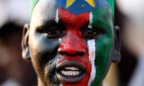
• The national flag is the same as that used by the rebel army, the SPLA, and consists of horizontal black, red and green stripes, separated by two thinner white bands. The thick stripes represent the black people, their blood and fertile land. White is for peace. The blue triangle at the flag's hoist symbolises the Nile, and the yellow star inside it the unity of the 10 states.
